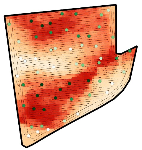

Implementation of Precision Agriculture involves the use of geospatial information to improve the understanding of the spatial heterogeneity of soil properties and crop performance. Accounting for local needs allows for the optimization of the use of agricultural inputs to maximize profitability and to reduce the negative environmental impact. Geographic information systems (GIS) have been used to manage, process, and interpret multiple geospatial data layers. This tutorial was developed to provide step-by-step instructions on the way in which an open-source, generic GIS software package could be used to process geospatial data for an agricultural field, Field 26, Macdonald Farm, McGill University, Ste-Anne-de-Bellevue, Quebec, Canada. This tutorial was developed based on QGIS version 2.18.16, with several important plugins, and SAGA GIS, version 6.2.0. This software is getting popular among both experienced users and beginners around the world. Open-source access to powerful analytical tools make it attractive for the initial exploration of geospatial data, including those related to crop production. Although this software is not specifically customized for agricultural data management, its powerful functionalities offer practical toolsets to meet the key requirements. All of the lessons are developed using a variety of input data files (i.e., spreadsheets, delimited text files, shape files, etc.) for an actual production field.